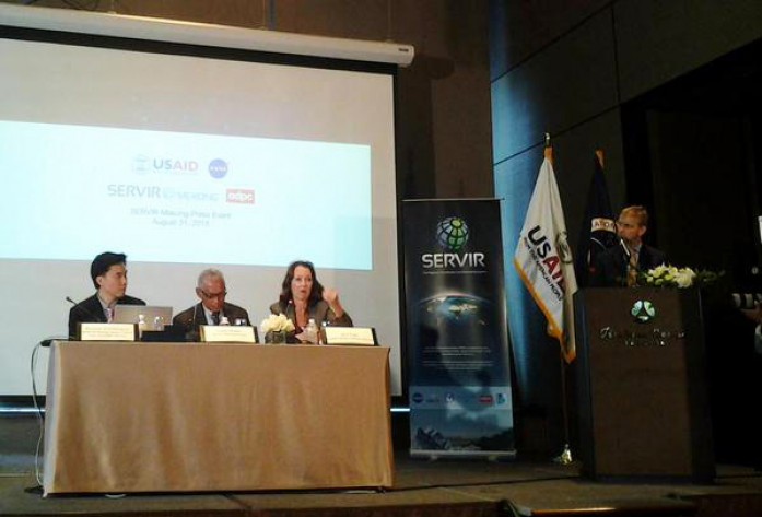
On Monday, August 31, 2015, The United States Agency for International Development (USAID) and the U.S. National Aeronautics and Space Administration (NASA) launched the technology for development project SERVIR-Mekong in Thailand. The project aims to promote the use of satellite imagery to assist the Lower Mekong region of Asia better predict and deal with floods and other natural disasters and increase resilience to the negative impacts of climate change. The project is funded by USAID and NASA and implemented by the Asian Disaster Preparedness Center and its partners. SERVIR-Mekong will help governments and other decision-makers in Burma, Cambodia, Laos, Thailand and Vietnam make use of publicly available satellite imagery, geospatial data and maps to make more informed decisions on important issues such as water management, land use planning, disaster risk reduction, infrastructure development and natural resources management. Read more here
Cross References
http://cambodia.usembassy.gov/083115_pr.html


