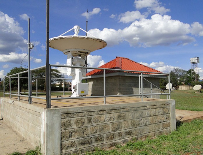
The Regional Centre for Mapping of Resources for Development (RCMRD) is one of the organizations using satellite data to better the lives of the ordinary population. With the satellite tracking system, Moderate Resolution Imaging Spectro-radiometer (MODIS) that enables the acquisition of near real-time data, RCMRD is able to help different
countries predict and cope with natural disasters and the effects of climate change. RCMRD has the capacity to play an important role in the development of validated, global, interactive earth system models able to predict global change accurately enough to assist policy makers in making sound decisions concerning the protection of the environment.
RCMRD has used satellite data to develop applications that have improved flood warning time, predicted frost, predicted forest fires, assessed water quality, predicted hailstorm, monitored crops, and prevented land degradation, among others. These applications have already resulted in measurable impacts. Also, RCMRD has built the capacity to use satellite data in the eastern and southern Africa region. This way, countries have been able to make better decisions and manage their resources more efficiently by helping people on the ground more accurately monitor disasters.
Cross reference
Eyes in the Sky: How Satellite Images Help People on the Ground
How NASA Data Can Save Lives From Space
NASA Data From Space Could Help the Developing World Prepare for Climate Change


