MESA
Project Objective
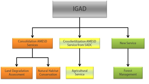
MESA programme in the IGAD region aims to enhance land degradation and natural habitats assessment and Forest Monitoring for sustainable management of environmental resources. This is achieved during the developing of operational geo-information services and by strengthening the information management capacity of regional and national institutions in order to support decision and policy making processes. MESA endeavours to facilitate access to Africa-wide environmental information derived from Earth Observation technologies.
Specific results were been formulated from the above objective:
- Improved access to existing basic EO, field and ancillary data ensured for users in the IGAD region.
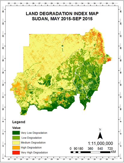
- Consolidation of existing operational information services established to improve policy and decision-making processes in Land Degradation Monitoring (LDM) and Natural Habitat Conservation (NHC) and development of a new Forest Monitoring (FM) service. The services produce and distribute regularly:
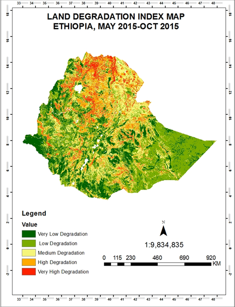
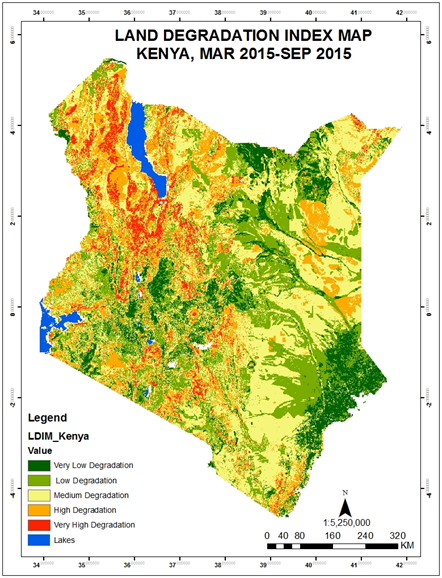
- land degradation index maps;
- land cover change indicators on IGAD selected Natural Habitats areas
- Forest degradation, deforestation extent, vulnerability index map over the whole IGAD region.
- Political and policy development frameworks are strengthened to ensure an active and sustainable participation of IGAD member states in global environmental surveillance initiatives.
- Adequate technical capacity
Overview of operational services in MESA IGAD
Countries covered by MESA IGAD
- Kenya
- Uganda
- Ethiopia
- Rwanda
- Burundi
- Sudan
- Southern Sudan
- Eritrea
- Djibouti
- Somalia
Target Users within the IGAD region:
- Policy and decision-makers of the environmental and agricultural sectors at regional and national levels
- Technical officers within environmental, agricultural, forest and mapping agencies; lecturers and researchers of local universities
Implementing Partners
| Partners |
|
| Associates Kenya |
|
| Uganda |
|
| Ethiopia |
|
| Rwanda |
|
| Burundi |
|
| Sudan |
|
| Southern Sudan |
|
| Eritrea |
|
| Djibouti |
|
| Somalia |
|
| MESA Contracting Authority African Union MESA Financing Authority/ Development partner |
European Union |
Important links
http://197.254.113.174/
Status: Active
 |
|
|
Agriculture practices on Hill slopes are destroying the forest resource, making the land fragile to soil erosion (Welkite area). |
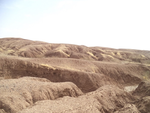
 Weak soil structure and devegetation increase runoff, causing land degradation (Asbe Tefer). Weak soil structure and devegetation increase runoff, causing land degradation (Asbe Tefer). |
 |
|
|
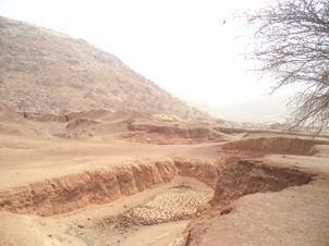
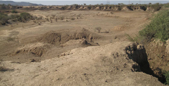
Deep gullies in Narok County have formed as a result of uncontrolled runoff. |
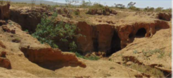
Gully erosion is eating away fertile topsoil in Elgeyo Marakwet, |
 |
|
|
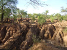
De-vegetated landscape has made the soil loose accelerating erosion (Karab) Sand deposits downslope; |
Visible gullies and scanty vegetation cover (El fao). |