![]()
![]()
"Excellent teaching staff. Excellent course structure. Good flexibility in choosing the courses."
The course is designed to give us the students a broad view of the field of photogrammetry and image interpretation and introduces students to aerial photographs and other remote sensing acquired data. "My experience in the program is positive. I am gaining practical experience and insights into the theories underpinning RS and Photogrammetry. My classmates and lecturers are warm and knowledgeable.

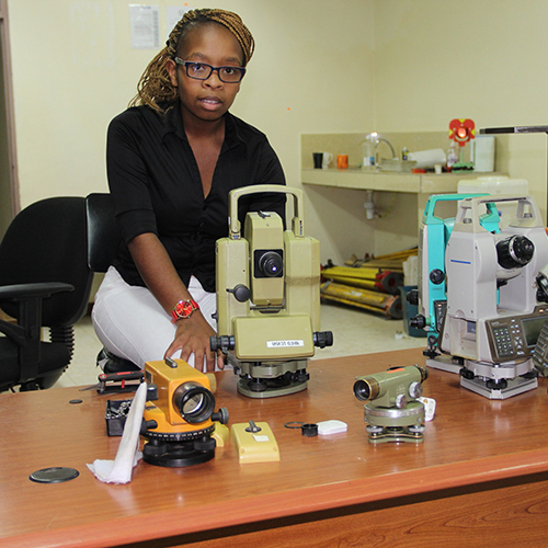
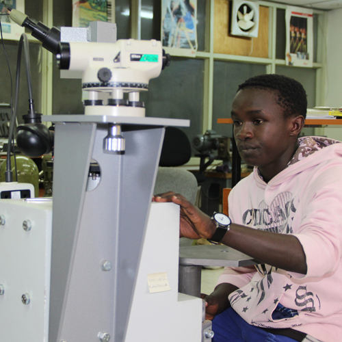
“We are not just the folks that hold a stick and legs beside the road. We survey and measure the land, for subdivisions. We also measure to see how high or low the property is above or below sea level. I would recommend ITTC it to others that have similar interests including; being outdoors, working at different places every day and enjoy mathematics. Thank you to Information Technology Training Centre (ITTC) section and my tutors for a great learning experience.
Roysambu, Kasarani
Nairobi, Kenya
+254 020 2680748 / 2680722
+254 723 786161 / +254 735 981098
P.O. Box 632-00618 Nairobi, Kenya
rcmrd@rcmrd.org


