Africa is facing a significant challenge with nearly two-thirds of its land being degraded. Degradation hinders optimal productivity of natural vegetation and systems and deters sustainable economic development, exacerbating the continents ability to build climate resilience.
The African Forest Landscape Restoration Initiative (AFR100), a Pan-African, country-led initiative aimed at restoring 100 million hectares of land in Africa by 2030 is looking to support countries to counter degradation challenges with an optimistic target of 100 million trees being restored. Currently, 33 countries have pledged to restore 128 million hectares of deforested and degraded forests and farmland, making Africa the region with the largest restoration opportunity in the world. The AFR100 Initiative aligns with various international agreements, such as the Bonn Challenge, the Paris Agreement on Climate Change, the New York Declaration on Forests, the African Resilient Landscapes Initiative (ARLI), the African Union Agenda 2063, and various Sustainable Development Goals.
To ensure the long-term success of restoration initiatives, it is essential to carefully monitor their performance and impacts using cost-effective, cutting-edge technology and crisp data analysis that is adapted to the landscape restoration context. That is where the Landscape Monitoring Accelerator comes in.
The Landscape Monitoring Accelerator led by the World Resources Institute is a program designed to bring together key aspects of tracking and evaluating restoration initiatives to ensure their long-term success. This includes deep tailored learning with top restoration monitoring professionals, exposure to the greatest restoration monitoring datasets and platforms available, and collaboration with decision-makers and geospatial specialists who work for regional, national, and local governments across AFR100 member countries. The objectives of the Landscape Monitoring Accelerator workshop is to build consensus on restoration monitoring at the local, national, and regional levels, discover restoration monitoring systems, identify bottlenecks in the design and/or monitoring practitioners with the finest available restoration monitoring methods, tools and gender and social equity dimensions in monitoring restoration.
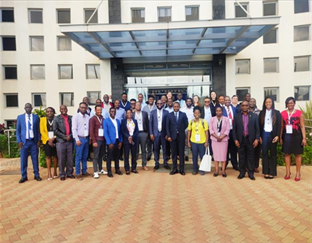
The World Resources Institute in partnership with Regional Center for Mapping of Resources for Development (RCMRD) organized the 2023 Regional Landscape Monitoring Accelerator Workshop which was held on 20th -24th March, 2023 at RCMRD’s campus in Nairobi. The one-week long workshop convened government representatives and restoration practitioners from the following AFR100 member countries: Cameroon (Ministry of Forestry and Wildlife and the Ministry of Environment), Ethiopia (Ethiopian Forest Development), Kenya (Makueni County, kenya Waters Agency, Kenya Forest Service, Kenya Forest Research Institute and Directorate of Remote Sensing and Resource Surveys), Malawi (Department of Land Resource Conservation, Department of Forestry, ), and Rwanda( Rwanda Space Agency, Albertine Rift Conservation Society, Rwanda Forest Authority, Ministry of Environment and ENABEL). It also brought in experts from African Development Agency (AUDA-NEPAD), RCMRD, ICRAF, REDD+ BIOPAMA, OFESA, the Michigan State University and the WRI to provide mentorship to the countries and share their knowledge and expertise.
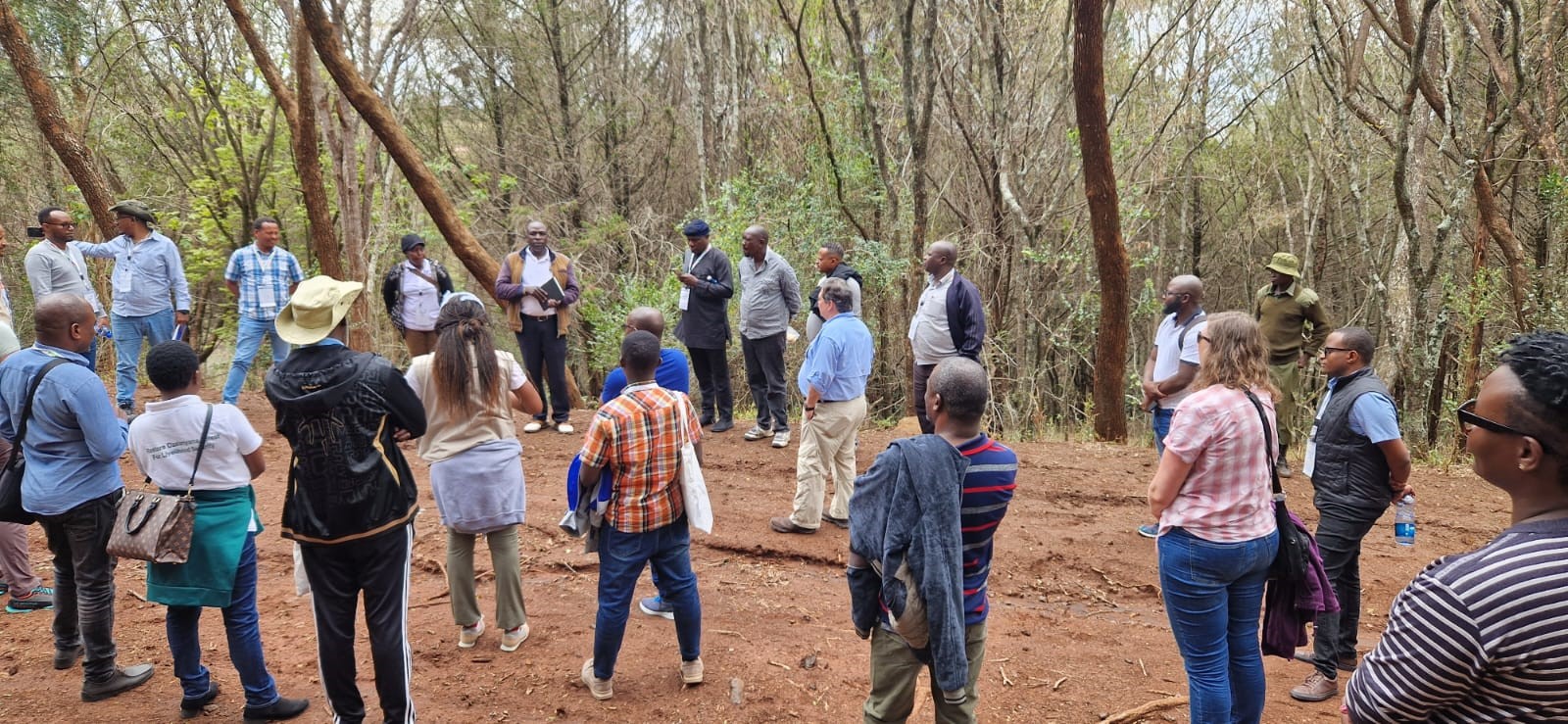
MSU led the participants in a field activity to share real life experience in collecting data for Carbon measurements, emphasizing that this was quite critical in deriving degradation activities across all landscapes.


